Geolocate

Rore topographic map

Click on the map to display elevation.

About this map
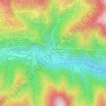
Name: Rore topographic map, elevation, terrain.

Location: Rore, Sampeyre, Cuneo, Piemonte, Italia (44.55660 7.20693 44.59660 7.24693)

Average elevation: 1,170 m

Minimum elevation: 779 m

Maximum elevation: 1,714 m

Gear up for your next adventure:

🚲Bikepacking Frame Bags - Storage for tools and navigation gear on long off-road rides
🛰️Outdoor GPS Navigation - Navigation devices for remote and off-grid areas
⛺Lightweight Tents - Compact tents for backpacking and trekking
🎒Replacement Sternum Straps - Repair parts for hiking rucksacks
🧼Technical Clothing Wash - Special soap to clean and restore waterproof membranes

As an Amazon Associate, this site earns from qualifying purchases at no extra cost to you.