
Thumanë topographic map
Interactive map
Click on the map to display elevation.
About this map
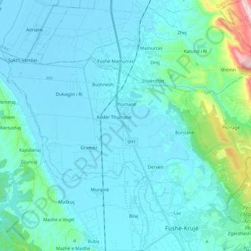
Name: Thumanë topographic map, elevation, terrain.
Location: Thumanë, Bashkia Krujë, Condado de Durrës, 1503, Albania (41.49372 19.56451 41.57835 19.75191)
Average elevation: 83 m
Minimum elevation: -3 m
Maximum elevation: 789 m