
Vizo topographic map
Interactive map
Click on the map to display elevation.
About this map
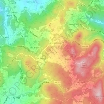
Name: Vizo topographic map, elevation, terrain.
Location: Vizo, Escariz, Arouca, Aveiro, 4540-320, Portugal (40.91470 -8.42540 40.95470 -8.38540)
Average elevation: 450 m
Minimum elevation: 279 m
Maximum elevation: 628 m
Other topographic maps
Click on a map to view its topography, its elevation and its terrain.