
Thank you for supporting this site ❤️
Make a donation
Make a donation
Gear up for your next adventure:
As an Amazon Associate, this site earns from qualifying purchases at no extra cost to you.
Flond topographic map
Click on the map to display elevation.
Thank you for supporting this site ❤️
Make a donation
Make a donation
Gear up for your next adventure:
As an Amazon Associate, this site earns from qualifying purchases at no extra cost to you.
About this map
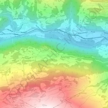
Name: Flond topographic map, elevation, terrain.
Location: Flond, Obersaxen-Mundaun, Surselva, Grisons, 7137, Switzerland (46.74756 9.14528 46.78756 9.18528)
Average elevation: 1,126 m
Minimum elevation: 700 m
Maximum elevation: 1,758 m
Thank you for supporting this site ❤️
Make a donation
Make a donation
Gear up for your next adventure:
As an Amazon Associate, this site earns from qualifying purchases at no extra cost to you.