Geolocate

Putha topographic map

Click on the map to display elevation.

About this map

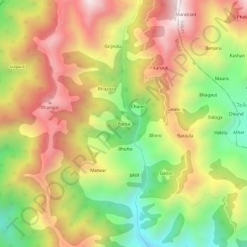
Name: Putha topographic map, elevation, terrain.

Location: Putha, Bhalai, Chamba, Himachal Pradesh, India (32.68702 75.92168 32.72702 75.96168)

Average elevation: 1,980 m

Minimum elevation: 1,485 m

Maximum elevation: 2,454 m

Gear up for your next adventure:

👟Men's Trail Running Shoes - Lightweight grip for fast movement over topographic contours
🔦LED Camping Lanterns - Illumination for reading maps inside your tent at night
🎒Hiking Daypacks - Compact backpacks ideal for short hikes and excursions
📦Compression Sacks - Reduce backpack volume efficiently
🔋Lithium AA Batteries - Long-lasting power that performs well in cold mountain weather

As an Amazon Associate, this site earns from qualifying purchases at no extra cost to you.