
Kapilvastu topographic map
Interactive map
Click on the map to display elevation.
About this map
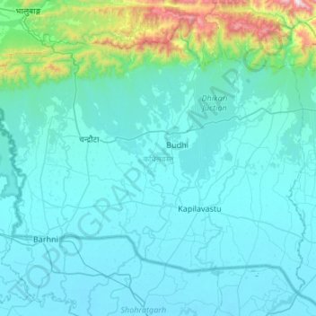
Name: Kapilvastu topographic map, elevation, terrain.
Location: Kapilvastu, Lumbini Province, 32809, Nepal (27.41789 82.69618 27.82060 83.23292)
Average elevation: 233 m
Minimum elevation: 87 m
Maximum elevation: 1,712 m
Other topographic maps
Click on a map to view its topography, its elevation and its terrain.