
San Cercle topographic map
Interactive map
Click on the map to display elevation.
About this map
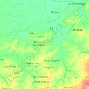
Name: San Cercle topographic map, elevation, terrain.
Location: San Cercle, Ségou Region, Mali (12.57500 -5.30610 13.64108 -4.51143)
Average elevation: 295 m
Minimum elevation: 262 m
Maximum elevation: 472 m
Other topographic maps
Click on a map to view its topography, its elevation and its terrain.