
Hadmersleben topographic map
Interactive map
Click on the map to display elevation.
About this map
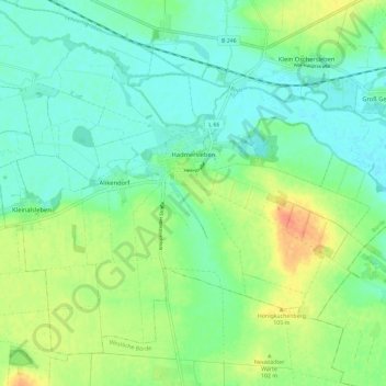
Name: Hadmersleben topographic map, elevation, terrain.
Location: Hadmersleben, Oschersleben, Börde, Saxony-Anhalt, Germany (51.95799 11.26327 52.01357 11.37964)
Average elevation: 87 m
Minimum elevation: 72 m
Maximum elevation: 117 m
Other topographic maps
Click on a map to view its topography, its elevation and its terrain.
Oschersleben
Germany > Saxony-Anhalt > Börde > Oschersleben
Oschersleben, Börde, Saxony-Anhalt, 39387, Germany
Average elevation: 112 m