
Stratford topographic map
Click on the map to display elevation.
About this map
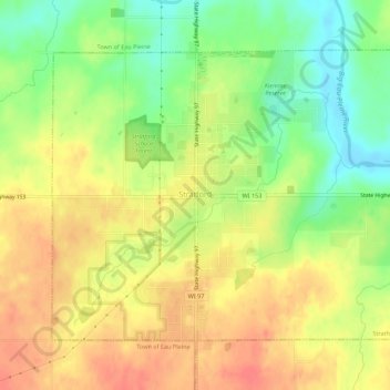
Name: Stratford topographic map, elevation, terrain.
Location: Stratford, Marathon County, Wisconsin, 54484, United States (44.78636 -90.09959 44.81554 -90.04456)
Average elevation: 382 m
Minimum elevation: 350 m
Maximum elevation: 408 m
Other topographic maps
Click on a map to view its topography, its elevation and its terrain.
George W Mead State Wildlife Management Area
United States > Wisconsin > Marathon County > Town of Bergen
Average elevation: 343 m