

Versailles topographic map
Click on the map to display elevation.
Versailles
Versailles is located 17.1 km (10.6 mi) west-southwest from the centre of Paris. The city sits on an elevated plateau, 130 to 140 metres (425 to 460 ft) above sea-level (whereas the elevation of the centre of Paris is only 33 m (108 ft) above sea level), surrounded by wooded hills: in the north the forests of Marly and Fausses-Reposes, and in the south the forests of Satory and Meudon.
About this map
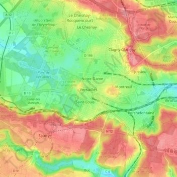
Name: Versailles topographic map, elevation, terrain.
Average elevation: 142 m
Minimum elevation: 99 m
Maximum elevation: 185 m
Other topographic maps
Click on a map to view its topography, its elevation and its terrain.


Le Champtier des Fourneaux
France > Ile-de-France > Yvelines > Dampierre-en-Yvelines
Average elevation: 143 m