
Blumenfeld topographic map
Interactive map
Click on the map to display elevation.
About this map
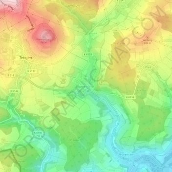
Name: Blumenfeld topographic map, elevation, terrain.
Average elevation: 609 m
Minimum elevation: 484 m
Maximum elevation: 772 m
Other topographic maps
Click on a map to view its topography, its elevation and its terrain.
Watterdingen
Deutschland > Baden-Württemberg > Landkreis Konstanz > Tengen
Watterdingen, Tengen, Landkreis Konstanz, Baden-Württemberg, 78250, Deutschland
Average elevation: 675 m