
Whately topographic map
Click on the map to display elevation.
About this map
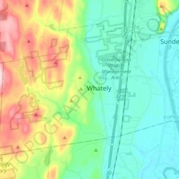
Name: Whately topographic map, elevation, terrain.
Location: Whately, Franklin County, Massachusetts, United States (42.40555 -72.70439 42.47288 -72.58110)
Average elevation: 115 m
Minimum elevation: 27 m
Maximum elevation: 336 m
Other topographic maps
Click on a map to view its topography, its elevation and its terrain.
North Sunderland
United States > Massachusetts > Franklin County > Sunderland
Average elevation: 100 m