Geolocate

Ruaka topographic map

Click on the map to display elevation.

About this map

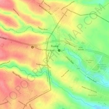
Name: Ruaka topographic map, elevation, terrain.

Location: Ruaka, Kiambaa, Kiambu, Kenya (-1.21379 36.76671 -1.20169 36.79327)

Average elevation: 1,753 m

Minimum elevation: 1,698 m

Maximum elevation: 1,790 m

Other topographic maps

Click on a map to view its topography, its elevation and its terrain.

Cianda ward

Kenya > Kiambu > Kiambaa

Average elevation: 1,887 m

Ndenderu ward

Kenya > Kiambu > Kiambaa

Average elevation: 1,854 m

Gear up for your next adventure:

👖Hiking Trousers - Durable trousers designed for rough terrain
🔥Emergency Fire Starters - Reliable ignition tools for survival situations in damp conditions
🚲Cycling GPS Computers - Track elevation and topographic routes on two wheels
🧤Hiking Gloves - Warm and durable gloves for cold-weather walks
👖Packable Overtrousers - Quick-deploy rain protection for legs in sudden storms

As an Amazon Associate, this site earns from qualifying purchases at no extra cost to you.