
Hua Na topographic map
Interactive map
Click on the map to display elevation.
About this map
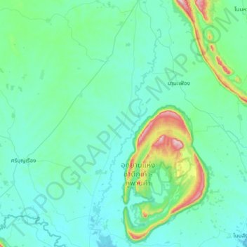
Name: Hua Na topographic map, elevation, terrain.
Location: Hua Na, Nǭngbūa Lamphū, Thailand (16.85335 102.25065 17.17335 102.57065)
Average elevation: 231 m
Minimum elevation: 177 m
Maximum elevation: 554 m
Other topographic maps
Click on a map to view its topography, its elevation and its terrain.
Nong Ruea
Nong Ruea, Nǭngbūa Lamphū, 39140, Thailand
Average elevation: 210 m
Nong Bua Lam Phu
Nong Bua Lam Phu, Nǭngbūa Lamphū, 39000, Thailand
Average elevation: 249 m
Ban Non Mueang
Ban Non Mueang, Nong Ruea, Nǭngbūa Lamphū, 39140, Thailand
Average elevation: 184 m