
Verbellabach topographic map
Interactive map
Click on the map to display elevation.
About this map
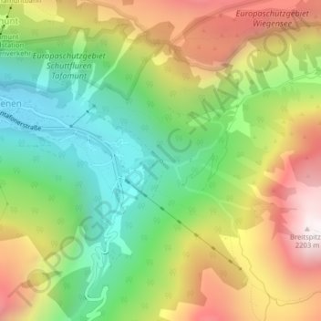
Name: Verbellabach topographic map, elevation, terrain.
Location: Verbellabach, Gaschurn, Bludenz, Vorarlberg, 6794, Österreich (46.96414 10.08021 46.96416 10.08033)
Average elevation: 1,543 m
Minimum elevation: 1,043 m
Maximum elevation: 2,194 m
Other topographic maps
Click on a map to view its topography, its elevation and its terrain.
Valschavielbach
Österreich > Vorarlberg > Gaschurn
Valschavielbach, Gaschurn, Bludenz, Vorarlberg, 6793, Österreich
Average elevation: 1,957 m
Klostertaler Bach
Österreich > Vorarlberg > Gaschurn
Klostertaler Bach, Gaschurn, Bludenz, Vorarlberg, Österreich
Average elevation: 2,470 m