
Zemplín topographic map
Interactive map
Click on the map to display elevation.
Zemplín
The village lies at an altitude of 106 metres and covers an area of 14,67 km². It is located near the junction point of the rivers Ondava and Latorica (tributaries of the river Bodrog) in eastern Slovakia.
About this map
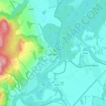
Name: Zemplín topographic map, elevation, terrain.
Average elevation: 116 m
Minimum elevation: 87 m
Maximum elevation: 242 m
Other topographic maps
Click on a map to view its topography, its elevation and its terrain.
Borša
Slovakia > Region of Košice > District of Trebišov
The village lies at an altitude of 102 metres and covers an area of 9.54 km². It has a population of about 1250 people.
Average elevation: 114 m
Kysta
Slovakia > Region of Košice > District of Trebišov
The village lies at an altitude of 151 metres and covers an area of 8.153 km². It has a population of about 410 people.
Average elevation: 177 m