
Thank you for supporting this site ❤️
Make a donation
Make a donation
Gear up for your next adventure:
As an Amazon Associate, this site earns from qualifying purchases at no extra cost to you.
Momostenango topographic map
Click on the map to display elevation.
Thank you for supporting this site ❤️
Make a donation
Make a donation
Gear up for your next adventure:
As an Amazon Associate, this site earns from qualifying purchases at no extra cost to you.
About this map
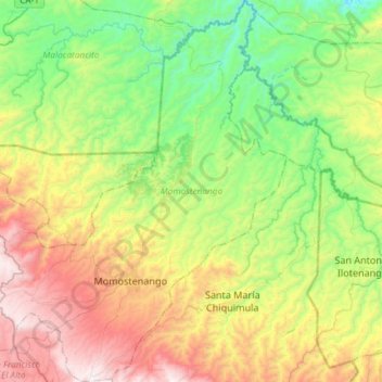
Name: Momostenango topographic map, elevation, terrain.
Location: Momostenango, Totonicapán, Guatemala (14.96947 -91.54854 15.25347 -91.28747)
Average elevation: 2,003 m
Minimum elevation: 1,473 m
Maximum elevation: 2,893 m
Thank you for supporting this site ❤️
Make a donation
Make a donation
Gear up for your next adventure:
As an Amazon Associate, this site earns from qualifying purchases at no extra cost to you.