
Dana Island topographic map
Interactive map
Click on the map to display elevation.
About this map
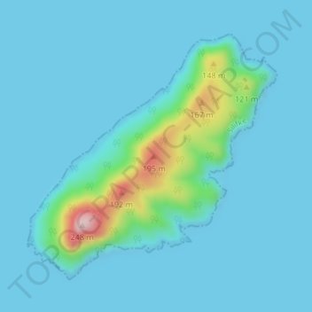
Name: Dana Island topographic map, elevation, terrain.
Location: Dana Island, Silifke, Mersin, Mediterranean Region, Turkey (36.17961 33.75695 36.20095 33.78373)
Average elevation: 28 m
Minimum elevation: 0 m
Maximum elevation: 252 m