
caïdat de Lamrija topographic map
Interactive map
Click on the map to display elevation.
About this map
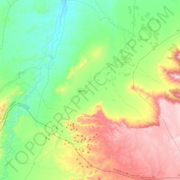
Name: caïdat de Lamrija topographic map, elevation, terrain.
Average elevation: 801 m
Minimum elevation: 391 m
Maximum elevation: 1,644 m
Other topographic maps
Click on a map to view its topography, its elevation and its terrain.
Middle Atlas
Maroc > Cercle de Guercif > Barkine
Middle Atlas, Barkine, caïdat de Barkine, Cercle de Guercif, Province de Guercif, Oriental, Maroc
Average elevation: 2,998 m
Saka
Saka, Caïdat de Saka, Cercle de Guercif, Province de Guercif, Oriental, 35105, Maroc
Average elevation: 650 m
Lamrija
Maroc > Cercle de Guercif > Lamrija
Lamrija, caïdat de Lamrija, Cercle de Guercif, Province de Guercif, Oriental, 35103, Maroc
Average elevation: 889 m