Geolocate

Warsash topographic map

Click on the map to display elevation.

About this map

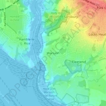
Name: Warsash topographic map, elevation, terrain.

Location: Warsash, Fareham, Hampshire, England, SO31 9AF, United Kingdom (50.83468 -1.31889 50.87468 -1.27889)

Average elevation: 15 m

Minimum elevation: -4 m

Maximum elevation: 55 m

Hampshire trails, hiking, mountain biking, running and outdoor activities

Gear up for your next adventure:

🥄Titanium Camping Sporks - The ultimate lightweight utensil for trail meals
📢Survival Whistles - Essential safety gear for signaling for help in mountain fog
🛌Sleeping Bags - Warm and packable sleeping bags for outdoor nights
🔦Waterproof LED Headlamps - Hands-free lighting for evening treks and emergency navigation
👖Hiking Trousers - Durable trousers designed for rough terrain

As an Amazon Associate, this site earns from qualifying purchases at no extra cost to you.