
Anguia topographic map
Interactive map
Click on the map to display elevation.
About this map
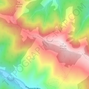
Name: Anguia topographic map, elevation, terrain.
Location: Anguia, Guriezo, Cantabria, 39709, España (43.31908 -3.27601 43.33908 -3.25601)
Average elevation: 355 m
Minimum elevation: 74 m
Maximum elevation: 595 m