Geolocate

Verín topographic map

Click on the map to display elevation.

About this map
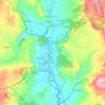
Name: Verín topographic map, elevation, terrain.

Location: Verín, Ourense, Galicia, Spain (41.80736 -7.47433 41.98303 -7.35277)

Average elevation: 581 m

Minimum elevation: 357 m

Maximum elevation: 1,085 m

Other topographic maps

Click on a map to view its topography, its elevation and its terrain.

Mandín

Spain > Galicia > Verín

Average elevation: 443 m

As Vendas da Barreira

Spain > Galicia > Verín > Riós

Average elevation: 802 m

San Pedro de Trasverea

Spain > Galicia > Verín > Riós

Average elevation: 894 m

Gear up for your next adventure:

🥤Hydration Bladders - Hands-free hydration systems for backpacks
🧦Hiking Socks - Breathable socks designed to prevent blisters on long walks
🍱Food Containers - Reusable containers for outdoor meals
🪢Paracord - Multi-purpose cord for camping and survival
🌂Windproof Trekking Umbrellas - Surprising but effective rain protection on low-wind trails

As an Amazon Associate, this site earns from qualifying purchases at no extra cost to you.