
Osterwede topographic map
Interactive map
Click on the map to display elevation.
About this map
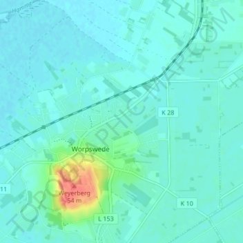
Name: Osterwede topographic map, elevation, terrain.
Average elevation: 8 m
Minimum elevation: 0 m
Maximum elevation: 51 m
Other topographic maps
Click on a map to view its topography, its elevation and its terrain.
Wörpedahl
Deutschland > Niedersachsen > Landkreis Osterholz > Worpswede
Wörpedahl, Worpswede, Landkreis Osterholz, Niedersachsen, 27726, Deutschland
Average elevation: 6 m
Überhamm
Deutschland > Niedersachsen > Landkreis Osterholz > Worpswede
Überhamm, Worpswede, Landkreis Osterholz, Niedersachsen, 27726, Deutschland
Average elevation: 5 m