
Al Batha topographic map
Interactive map
Click on the map to display elevation.
About this map
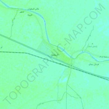
Name: Al Batha topographic map, elevation, terrain.
Average elevation: 8 m
Minimum elevation: 4 m
Maximum elevation: 11 m
Other topographic maps
Click on a map to view its topography, its elevation and its terrain.
المعامل الحكومية
المعامل الحكومية, Al-Nasiriyah Central Subdistrict, Al-Nasiriyah District, Dhi Qar Governorate, Iraq
Average elevation: 5 m
Al-Dawayah District
Al-Dawayah District, Dhi Qar Governorate, 64012, Iraq
Average elevation: 8 m
Al-Rifa'i District
Al-Rifa'i District, Dhi Qar Governorate, Iraq
Average elevation: 9 m
Tell el-'Oueili
Iraq > Dhi Qar Governorate > Al-Rifa'i District
Tell el-'Oueili, الطريق بغداد - البصرة, Al-Nasr Subdistrict, Al-Rifa'i District, Al-Batha Subdistrict, Al-Nasiriyah District, Dhi Qar Governorate, Iraq
Average elevation: 7 m
Euphrates
Iraq > Dhi Qar Governorate > Nasiriyah
Euphrates, Nasiriyah, Al-Nasiriyah Central Subdistrict, Al-Nasiriyah District, Dhi Qar Governorate, Iraq
Average elevation: 6 m
Qaryat al Karush
Iraq > Dhi Qar Governorate > Qaryat al Karush
Qaryat al Karush, Al-Nasiriyah Central Subdistrict, Al-Nasiriyah District, Dhi Qar Governorate, Iraq
Average elevation: 5 m
Jamaat ash Shaykh
Iraq > Dhi Qar Governorate > Harran as Sajit > Jamaat ash Shaykh
Jamaat ash Shaykh, Harran as Sajit, Al-Dawayah Central Subdistrict, Al-Dawayah District, Dhi Qar Governorate, Iraq
Average elevation: 7 m
Al Kurmashiyah ash Sharqiyah
Iraq > Dhi Qar Governorate > Al Kurmashiyah ash Sharqiyah
Al Kurmashiyah ash Sharqiyah, Karmat Bani Saad Subdsitrict, Sooq Ash-Shuyookh District, Dhi Qar Governorate, Iraq
Average elevation: 4 m