
Thank you for supporting this site ❤️
Make a donation
Make a donation
Gear up for your next adventure:
As an Amazon Associate, this site earns from qualifying purchases at no extra cost to you.
Wroclaw topographic map
Click on the map to display elevation.
Thank you for supporting this site ❤️
Make a donation
Make a donation
Gear up for your next adventure:
As an Amazon Associate, this site earns from qualifying purchases at no extra cost to you.
About this map
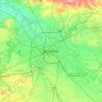
Name: Wroclaw topographic map, elevation, terrain.
Location: Wroclaw, Wrocław, Lower Silesian Voivodeship, 50-001, Poland (50.94898 16.87267 51.26898 17.19267)
Average elevation: 130 m
Minimum elevation: 99 m
Maximum elevation: 233 m
Thank you for supporting this site ❤️
Make a donation
Make a donation
Gear up for your next adventure:
As an Amazon Associate, this site earns from qualifying purchases at no extra cost to you.