
Thank you for supporting this site ❤️
Make a donation
Make a donation
Gear up for your next adventure:
As an Amazon Associate, this site earns from qualifying purchases at no extra cost to you.
Chengkou County topographic map
Click on the map to display elevation.
Thank you for supporting this site ❤️
Make a donation
Make a donation
Gear up for your next adventure:
As an Amazon Associate, this site earns from qualifying purchases at no extra cost to you.
About this map
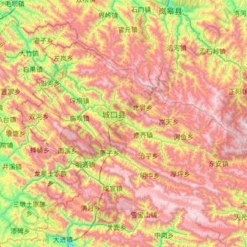
Name: Chengkou County topographic map, elevation, terrain.
Location: Chengkou County, 渝东北三峡库区城镇群区位, Chongqing, China (31.62504 108.25563 32.20366 109.27916)
Average elevation: 1,418 m
Minimum elevation: 319 m
Maximum elevation: 2,766 m
Thank you for supporting this site ❤️
Make a donation
Make a donation
Gear up for your next adventure:
As an Amazon Associate, this site earns from qualifying purchases at no extra cost to you.