Geolocate

Wadi Musa topographic map

Click on the map to display elevation.

About this map
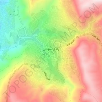
Name: Wadi Musa topographic map, elevation, terrain.

Location: Wadi Musa, Maan, Jordan (30.30481 35.46588 30.33681 35.49924)

Average elevation: 1,235 m

Minimum elevation: 959 m

Maximum elevation: 1,475 m

Gear up for your next adventure:

🗺️Ordnance Survey Maps - Essential paper maps for hiking across the UK national parks
🧥Waterproof Hiking Jackets - Rain protection for walking in all weather conditions
📷Outdoor Action Cameras - Cameras designed for hiking and adventure
🧺Ultralight Dry Bags - Organize and waterproof your gear inside your rucksack
🧭Orienteering Compasses - Accurate compasses for map-based navigation

As an Amazon Associate, this site earns from qualifying purchases at no extra cost to you.