
Movelier topographic map
Interactive map
Click on the map to display elevation.
About this map
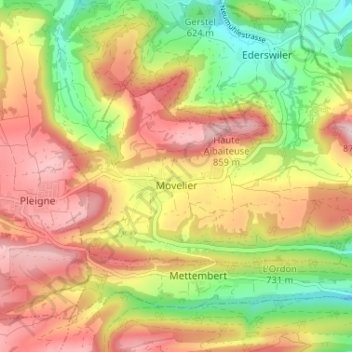
Name: Movelier topographic map, elevation, terrain.
Location: Movelier, District de Delémont, Jura, 2812, Suisse (47.39956 7.29826 47.42150 7.36313)
Average elevation: 699 m
Minimum elevation: 526 m
Maximum elevation: 862 m