
Stillwater topographic map
Interactive map
Click on the map to display elevation.
About this map
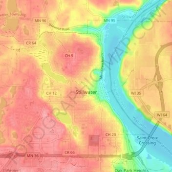
Name: Stillwater topographic map, elevation, terrain.
Location: Stillwater, Washington County, Minnesota, United States (45.03135 -92.86324 45.08012 -92.78552)
Average elevation: 259 m
Minimum elevation: 203 m
Maximum elevation: 296 m
Other topographic maps
Click on a map to view its topography, its elevation and its terrain.
Twin Pine Mobile Home Park
United States > Minnesota > Washington County > Hugo
Average elevation: 282 m