
Mele topographic map
Interactive map
Click on the map to display elevation.
About this map
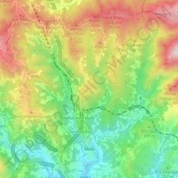
Name: Mele topographic map, elevation, terrain.
Location: Mele, Gênes, Ligurie, Italie (44.44229 8.70808 44.48949 8.78427)
Average elevation: 383 m
Minimum elevation: 23 m
Maximum elevation: 905 m