Geolocate

Lesteven topographic map

Click on the map to display elevation.

About this map
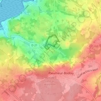
Name: Lesteven topographic map, elevation, terrain.

Location: Lesteven, Pleumeur-Bodou, Lannion, Côtes-d'Armor, Bretagne, France métropolitaine, 22560, France (48.76212 -3.54508 48.80212 -3.50508)

Average elevation: 59 m

Minimum elevation: 0 m

Maximum elevation: 104 m

Other topographic maps

Click on a map to view its topography, its elevation and its terrain.

22560

France > Bretagne > Côtes-d'Armor > Pleumeur-Bodou

Average elevation: 41 m

Gear up for your next adventure:

🦯Walking Poles - Supportive poles for long-distance walking
🎒Hiking Child Carriers - Explore the outdoors with the whole family safely
📦Compression Sacks - Reduce backpack volume efficiently
🛌Insulated Sleeping Mats - Crucial thermal protection when sleeping on cold, uneven ground
🧴Sport Sunscreen Sticks - High-protection sunblock that won't run into your eyes on the trail

As an Amazon Associate, this site earns from qualifying purchases at no extra cost to you.