
العامرية topographic map
Interactive map
Click on the map to display elevation.
About this map
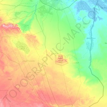
Name: العامرية topographic map, elevation, terrain.
Location: العامرية, معتمدية بنقردان, Médenine, Tunisia (32.37674 11.08482 33.12822 11.34185)
Average elevation: 78 m
Minimum elevation: -5 m
Maximum elevation: 230 m
Other topographic maps
Click on a map to view its topography, its elevation and its terrain.
Djerba Island
Djerba Island, ربانة, معتمدية جربة ميدون, Médenine, Tunisia
Average elevation: 7 m
عمر الجديدة
عمر الجديدة, معتمدية مدنين االجنوبية, Médenine, Tunisia
Average elevation: 33 m