
Windhahn topographic map
Interactive map
Click on the map to display elevation.
About this map
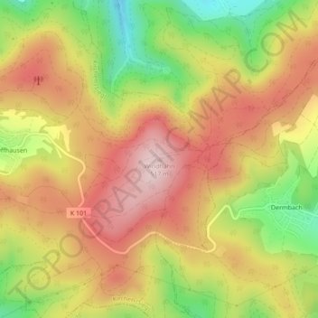
Name: Windhahn topographic map, elevation, terrain.
Average elevation: 399 m
Minimum elevation: 238 m
Maximum elevation: 523 m
Schild mit Höhenangabe auf dem Windhahngipfel
Other topographic maps
Click on a map to view its topography, its elevation and its terrain.
Offhausen
Deutschland > Rheinland-Pfalz > Kirchen (Sieg) > Offhausen
Offhausen, Kirchen (Sieg), Landkreis Altenkirchen, Rheinland-Pfalz, 57562, Deutschland
Average elevation: 331 m