Geolocate

Arthog topographic map

Click on the map to display elevation.

About this map

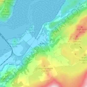
Name: Arthog topographic map, elevation, terrain.

Location: Arthog, Gwynedd, Wales, LL39 1YU, United Kingdom (52.69165 -4.02778 52.73165 -3.98778)

Average elevation: 127 m

Minimum elevation: -1 m

Maximum elevation: 481 m

Gwynedd trails, hiking, mountain biking, running and outdoor activities

Gear up for your next adventure:

🧰Survival Kits - Emergency tools for remote environments
🧼Biodegradable Soap - Leave-no-trace hygiene for multi-day mountain treks
🎒Hiking Child Carriers - Explore the outdoors with the whole family safely
🧗Locking Carabiners - Secure gear to your pack or for light technical use
🥄Titanium Camping Sporks - The ultimate lightweight utensil for trail meals

As an Amazon Associate, this site earns from qualifying purchases at no extra cost to you.