
Coldcut topographic map
Interactive map
Click on the map to display elevation.
About this map
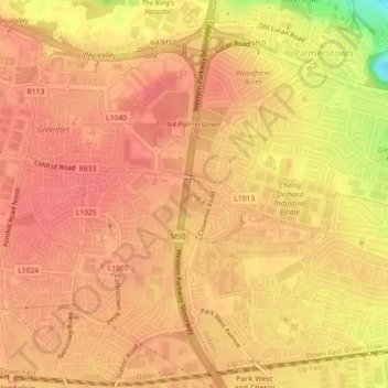
Name: Coldcut topographic map, elevation, terrain.
Average elevation: 56 m
Minimum elevation: 8 m
Maximum elevation: 70 m
Other topographic maps
Click on a map to view its topography, its elevation and its terrain.
Palmerstown Village ED
Palmerstown Village ED, Dublin 20, South Dublin, County Dublin, Leinster, Ireland
Average elevation: 50 m
Redcowfarm
Redcowfarm, Palmerstown Village ED, Dublin 20, South Dublin, County Dublin, Leinster, Ireland
Average elevation: 45 m