
Hilpoltstein topographic map
Interactive map
Click on the map to display elevation.
About this map
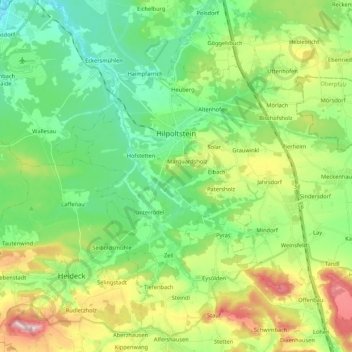
Name: Hilpoltstein topographic map, elevation, terrain.
Location: Hilpoltstein, Roth, Bavaria, 91161, Germany (49.12640 11.11503 49.21764 11.32773)
Average elevation: 418 m
Minimum elevation: 331 m
Maximum elevation: 600 m
Other topographic maps
Click on a map to view its topography, its elevation and its terrain.