
Vimperk topographic map
Interactive map
Click on the map to display elevation.
Vimperk
Vimperk is located about 17 kilometres (11 mi) south of Prachatice and 50 km (31 mi) west of České Budějovice. The southern half of the municipal territory lies the Bohemian Forest and is protected as the Šumava Protected Landscape Area; the northern part lies in the Bohemian Forest Foothills. The highest point is the Šerava mountain with an altitude of 1,061 metres (3,481 ft). Other high mountains include Kamenná hora at 1,057 metres (3,468 ft) and Kupa at 1,044 metres (3,425 ft). The town is situated in the Volyňka River valley.
About this map
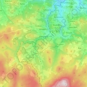
Name: Vimperk topographic map, elevation, terrain.
Average elevation: 850 m
Minimum elevation: 546 m
Maximum elevation: 1,348 m
Other topographic maps
Click on a map to view its topography, its elevation and its terrain.