
丁家山 topographic map
Interactive map
Click on the map to display elevation.
About this map
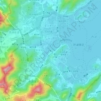
Name: 丁家山 topographic map, elevation, terrain.
Location: 丁家山, 西湖街道, 西湖区, 杭州市, 浙江省, 310007, 中国 (30.22041 120.10326 30.26041 120.14326)
Average elevation: 50 m
Minimum elevation: 5 m
Maximum elevation: 247 m
Other topographic maps
Click on a map to view its topography, its elevation and its terrain.