Geolocate

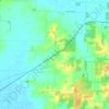
Griffin topographic map

Click on the map to display elevation.

About this map

Name: Griffin topographic map, elevation, terrain.

Location: Griffin, Posey County, Indiana, United States (38.20051 -87.91621 38.20800 -87.91298)

Average elevation: 120 m

Minimum elevation: 109 m

Maximum elevation: 150 m

Other topographic maps

Click on a map to view its topography, its elevation and its terrain.
Caborn

United States > Indiana > Posey County

Average elevation: 126 m

New Harmony

United States > Indiana > Posey County > New Harmony

Average elevation: 121 m

Gear up for your next adventure:

🧤Thermal Touchscreen Gloves - Stay warm while operating your GPS or smartphone camera
🧢Waterproof Hiking Hats - Keep the rain off your face while studying topographic maps
🧣Fleece Neck Warmers - Extra insulation for winter topographic surveys
🦯Walking Poles - Supportive poles for long-distance walking
🧺Mesh Stuff Sacks - Breathable storage for wet gear or camp organization

As an Amazon Associate, this site earns from qualifying purchases at no extra cost to you.