
Bodenwöhr topographic map
Interactive map
Click on the map to display elevation.
About this map
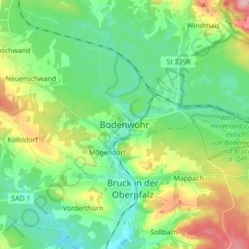
Name: Bodenwöhr topographic map, elevation, terrain.
Location: Bodenwöhr, Landkreis Schwandorf, Bayern, 92439, Deutschland (49.23049 12.26432 49.31049 12.34432)
Average elevation: 403 m
Minimum elevation: 354 m
Maximum elevation: 515 m