
Sendawar topographic map
Interactive map
Click on the map to display elevation.
About this map
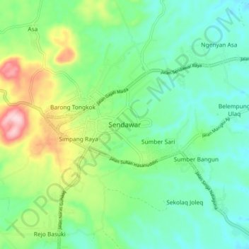
Name: Sendawar topographic map, elevation, terrain.
Average elevation: 152 m
Minimum elevation: 70 m
Maximum elevation: 354 m
Other topographic maps
Click on a map to view its topography, its elevation and its terrain.
Melak Ulu
Indonesia > East Kalimantan > Kutai Barat
Melak Ulu, Kutai Barat, East Kalimantan, Kalimantan, 75765, Indonesia
Average elevation: 19 m