
Nugaal topographic map
Interactive map
Click on the map to display elevation.
About this map
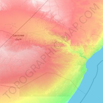
Name: Nugaal topographic map, elevation, terrain.
Location: Nugaal, Garowe District, Nugaal, Puntland, Somalia (7.12122 48.13439 9.12122 50.13439)
Average elevation: 390 m
Minimum elevation: 0 m
Maximum elevation: 926 m
Other topographic maps
Click on a map to view its topography, its elevation and its terrain.
Garoowe
Somalia > Nugaal > Garowe District
Garoowe, Garowe District, Nugaal, Puntland, Somalia
Average elevation: 486 m