
Châtillon topographic map
Interactive map
Click on the map to display elevation.
About this map
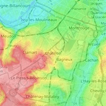
Name: Châtillon topographic map, elevation, terrain.
Average elevation: 90 m
Minimum elevation: 27 m
Maximum elevation: 187 m
La superficie de la commune est de 292 hectares ; l'altitude varie de 78 à 164 mètres.