
Aïn Touta topographic map
Interactive map
Click on the map to display elevation.
About this map
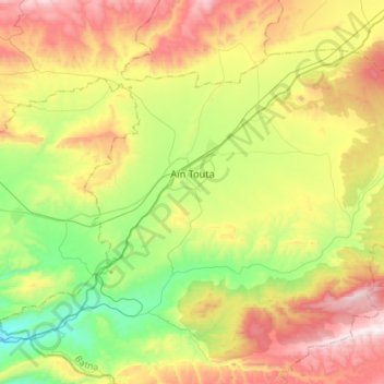
Name: Aïn Touta topographic map, elevation, terrain.
Location: Aïn Touta, Aïn Touta district, Batna, Algeria (35.27631 5.74813 35.45166 6.03700)
Average elevation: 1,033 m
Minimum elevation: 603 m
Maximum elevation: 1,646 m