
Kawthaung topographic map
Interactive map
Click on the map to display elevation.
About this map
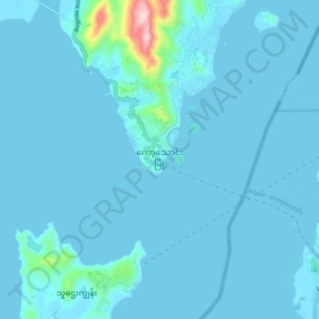
Name: Kawthaung topographic map, elevation, terrain.
Average elevation: 18 m
Minimum elevation: -2 m
Maximum elevation: 359 m
Other topographic maps
Click on a map to view its topography, its elevation and its terrain.
Eagle Rock Overlook
Myanmar > Tanintharyi Region > Kawthoung Township
Eagle Rock Overlook, Eagle Rock Hiking trail, Kawthoung Township, Kawthoung District, Tanintharyi Region, Myanmar
Average elevation: 3 m