
Quelle Formarinbach topographic map
Interactive map
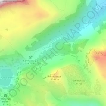
Click on the map to display elevation.
About this map
Name: Quelle Formarinbach topographic map, elevation, terrain.
Average elevation: 2,023 m
Minimum elevation: 1,656 m
Maximum elevation: 2,647 m
Other topographic maps
Click on a map to view its topography, its elevation and its terrain.
Dalaas
Österreich > Vorarlberg > Dalaas
Dalaas, Bezirk Bludenz, Vorarlberg, 6752, Österreich
Average elevation: 1,256 m