
Congé topographic map
Interactive map
Click on the map to display elevation.
About this map
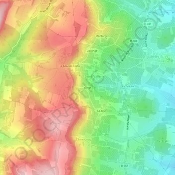
Name: Congé topographic map, elevation, terrain.
Average elevation: 324 m
Minimum elevation: 216 m
Maximum elevation: 446 m
Other topographic maps
Click on a map to view its topography, its elevation and its terrain.
Collonge
France > Bourgogne-Franche-Comté > Saône-et-Loire > Saint-Vallerin
Collonge, Saint-Vallerin, Chalon-sur-Saône, Saône-et-Loire, Bourgogne-Franche-Comté, France métropolitaine, 71390, France
Average elevation: 322 m