
Bečići topographic map
Interactive map
Click on the map to display elevation.
About this map
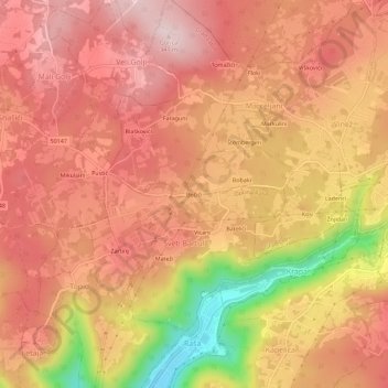
Name: Bečići topographic map, elevation, terrain.
Location: Bečići, Grad Labin, Istria County, 52223, Croatia (45.07594 14.06410 45.11594 14.10410)
Average elevation: 228 m
Minimum elevation: 7 m
Maximum elevation: 335 m