
Gypsy Peak topographic map
Interactive map
Click on the map to display elevation.
About this map
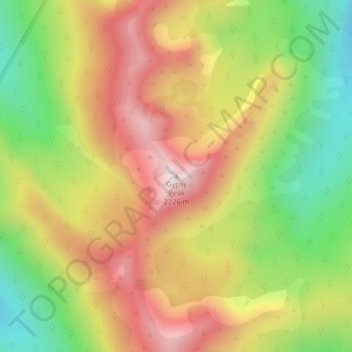
Name: Gypsy Peak topographic map, elevation, terrain.
Location: Gypsy Peak, Pend Oreille County, Washington, United States (48.94571 -117.15224 48.94581 -117.15214)
Average elevation: 1,893 m
Minimum elevation: 1,557 m
Maximum elevation: 2,217 m
Other topographic maps
Click on a map to view its topography, its elevation and its terrain.