Geolocate

Ramsgate topographic map

Click on the map to display elevation.

About this map

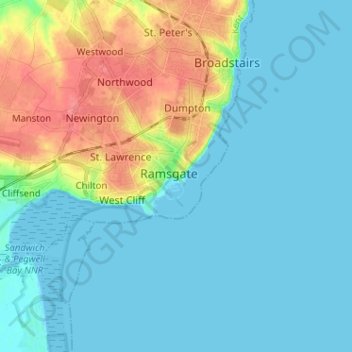
Name: Ramsgate topographic map, elevation, terrain.

Location: Ramsgate, Kent, South East, England, CT11 9AD, United Kingdom (51.29347 1.37965 51.37347 1.45965)

Average elevation: 15 m

Minimum elevation: 0 m

Maximum elevation: 56 m

England trails, hiking, mountain biking, running and outdoor activities

Gear up for your next adventure:

🧢Hiking Hats - Sun and weather protection for outdoor walks
🗺️Topographic Maps - Detailed maps showing elevation and terrain features
🛌Sleeping Bags - Warm and packable sleeping bags for outdoor nights
🗺️Scratch-off Peak Maps - Track your progress climbing Munros or Wainwrights
📚UK Hiking Guidebooks - Detailed route descriptions for the Lake District, Peaks, and Highlands

As an Amazon Associate, this site earns from qualifying purchases at no extra cost to you.